


1768 - The British Occupation of Boston
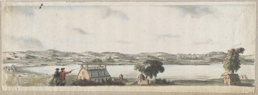
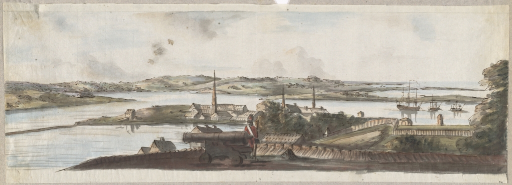
When the British soldiers arrived in Boston in 1768 they brought something else in addition to muskets, cannon and bayonets. Skilled surveyors also traveled with the Redcoats. Surveyors began drawing everything from battle plans, fort layouts, roads and the coastlines of Boston and nearby towns. First meant for military purposes only; maps, sketches, and battle plans were sent back to England and published in newspapers were they became extremely popular among the public as a way to keep track of the revolution. The records of British surveyors include many detailed maps and drawings of the British occupation of Boston. One of the most talented of these British surveyors was a twenty-fiver-year-old officer in the Royal Welch Fusiliers, Lieutenant Richard Williams. He mapped and sketched the town of Boston and kept a journal, later published as Discord and Civil Wars. In addition to mapping and sketching British positions in Boston, Williams also created an incredible set of watercolor paintings showing a 360-degree view of Boston and its surroundings from atop Beacon Hill. These paintings provide a remarkably realistic view of Boston at the beginning of the American revolution, long before the invention of photography!
"I went to the common & Beacon Hill, where I saw all our encampments, & those of the Enemy. From this hill you have a view of the town and country around it." Richard Williams. II.
|
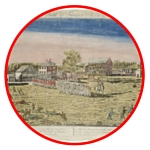
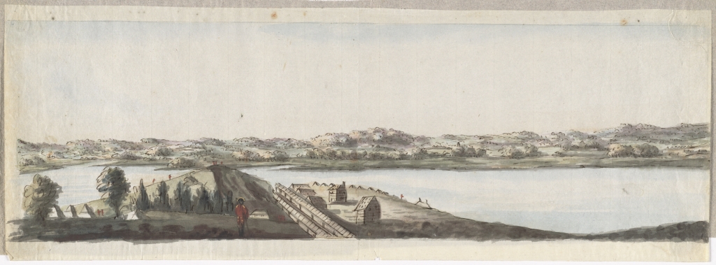
Title: Dorchester Neck
Author: Williams, Richard Date: 1775 https://collections.leventhalmap.org/search/commonwealth:dz010v582 |
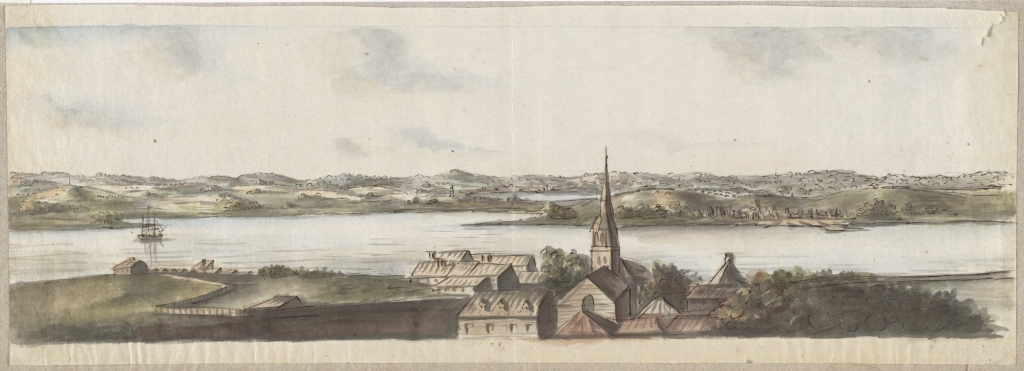
Title: Boston Neck, with the British lines and John Hancock's house
Author: Williams, Richard Date: 1775 https://collections.leventhalmap.org/search/commonwealth:dz010v603 |
Title: Noodle Island and the Mill Pond
Author: Williams, Richard Date: 1775 https://collections.leventhalmap.org/search/commonwealth:dz010v66r |
|
Title: Charlestown Promontory, the ruins of the town after the Battle of Bunker Hill and General Howe's encampment
Author: Williams, Richard Date: 1775 https://collections.leventhalmap.org/search/commonwealth:dz010v646 |
Title: Cambridge with Washington's headquarters
Author: Williams, Richard Date: 1775 https://collections.leventhalmap.org/search/commonwealth:dz010v62n |
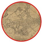
William's also produced one of the first maps printed of Boston and includes incredibly detailed information about the location of British and American troops in and around Boston during the period of British occupation.

Title: Boston 1775
Author: Richard Williams
Date: 1775
Title: A Plan of Boston and its environs
URL: https://collections.leventhalmap.org/search/commonwealth:3f462w352
Author: Richard Williams
Date: 1775
Title: A Plan of Boston and its environs
URL: https://collections.leventhalmap.org/search/commonwealth:3f462w352
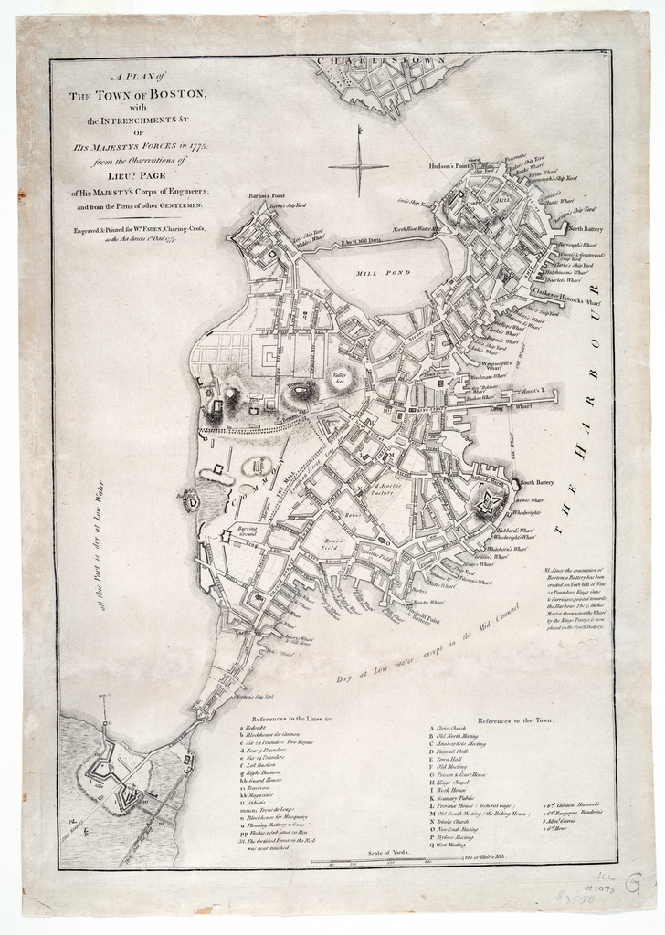
The moment the British landed troops in 1768, they began to use the geography of Boston to their advantage. They positioned ships to control shipping lanes in and out of Boston Harbor. Floating batteries and fortifications were built in the Charles River and on the "neck" to block access to Boston, isolating inhabitants on the peninsula. British records and maps identify military equipment, fortifications, and even include specific details about, the location of officers' headquarters, troops by units, and the number and size of their cannons. In several maps, the British were also sure to make note the of American camps and lines of Generals Putnam, Ward, and Thompson, in the surrounding communities of Cambridge, Brookline, and Roxbury.

|
Title: Exact plan of General Gage's lines on Boston Neck in America
Publisher: Aitken, Robert Date: 1775 Location: Boston (Mass.) URL: http://maps.bpl.org/id/rb15800 |
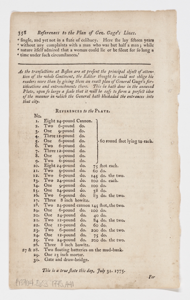
Title: References to the plan of Gen. Gage's lines
Author: Aitken, Robert Publisher: Aitken, Robert Date: 1775 Location: Boston (Mass.) URL: http://maps.bpl.org/id/n50442 |

|
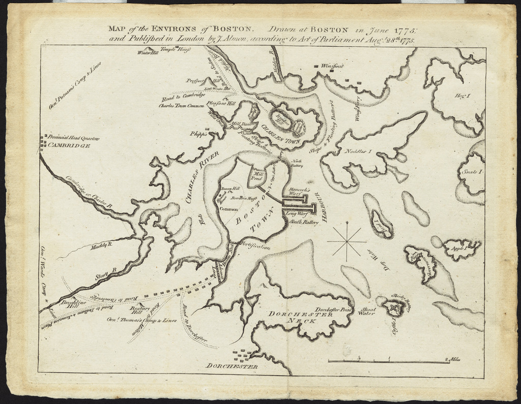
Title: Map of the Environs of Boston
Author: Almon, John Publisher: Almon, John Date: 1775 Location: Boston (Mass.), Boston and vicinity URL: http://maps.bpl.org/id/10032 |
Title: A plan of the town of Boston, with the intrenchments &c. of His Majestys forces in 1775
Author: Page, Thomas Hyde Publisher: Faden, William Date: 1775 URL: https://collections.leventhalmap.org/search/commonwealth:3f462w86j |
OOPpTitle: A new and correct plan of the town of Boston and Provincial camp
Author: Aitken, Robert Date: 1775 Location: Boston (Mass.), Boston and vicinity URL: https://collections.leventhalmap.org/search/commonwealth:z603vh63g |
